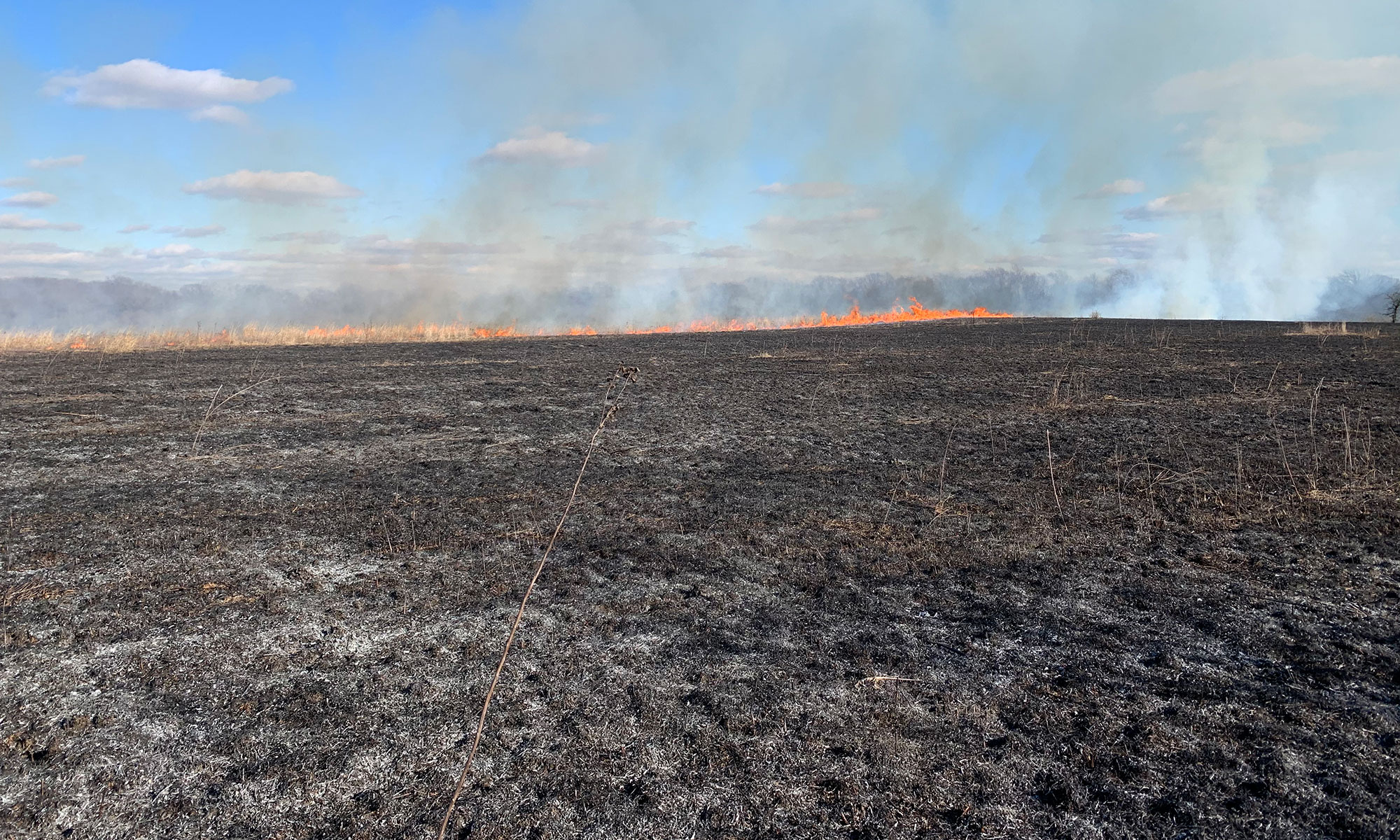
Dr. Aiuvalasit has a long-standing research interest in ancient water management. Like studies of fire or ancient vegetation, evidence for how people related to water in the past is often most amenable to study through environmental archaeology. Ancient earthen dams, irrigation canals, and changes to hydrological regimes in the past are often best analyzed using geoarchaeological approaches. Learning how communities solved water management problems in the past provides clear and relevant examples to the water challenges communities face today.
Irrigation and large-scale pre-Hispanic water management in the Tehaucan Valley, Mexico
Some of the largest Indigenous water management features in the Americas are in the Tehuacán Valley in the highlands of Central Mexico. In this arid setting, water management is required to support agriculture. Dr. Aiuvalasit has been involved in geoarchaeological studies of the chronology of the Purrón Dam, the largest pre-Hispanic earthen dam in the Americas. He has also been part of a team that synthesized mapping and chronological data of the uniquely well preserved prehispanic irrigation networks of the Tehuacán Valley. The mapped system adds up to nearly over 400 km of travertine canals interconnecting multiple spring-fed irrigation systems. Newly reported dates of the canals suggests they may be up to 5,000 years old, and that the system was founded well before Indigenous towns and cities emerged within these networks. Instead, the system appears to have developed when Indigenous peoples were growing early forms of domesticated maize, which shows how plant domestication and water management can emerge in tandem among small-scale communities. Some of these networks are still in use, making this one of the oldest continually used water management systems in the world.


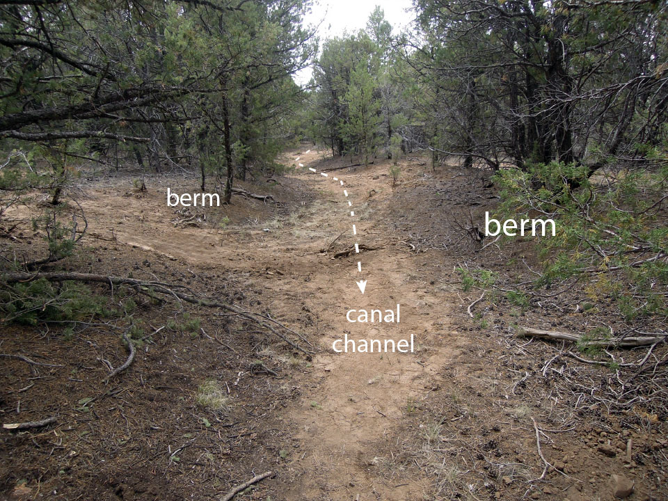
When is a canal not a canal? Site formation processes of a possible canal near Taos, New Mexico
Geoarchaeological studies are essential to determine when and how an ancient irrigation canals functioned. Each stage of the life history an irrigation canal can leave behind traces on landscapes and in sedimentary records. In collaboration with Dr. Michael Adler at SMU and the SMU-in-Taos campus, EAL is completing a geoarchaeological study of a purported irrigation canal near Taos, New Mexico. This study shows the utility of evaluating multiple lines of geoarchaeological evidence against a model for the construction, use, and abandonment of canals. Beyond its importance for research questions related to the long history of people and water, such findings are relevant to legal questions regarding water rights and access.
Ancestral Pueblo water management and climate change in the Jemez Mountains, New Mexico
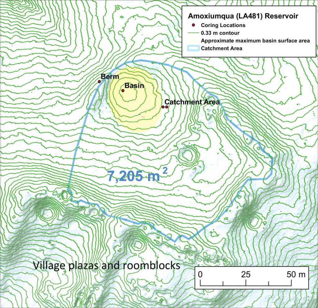
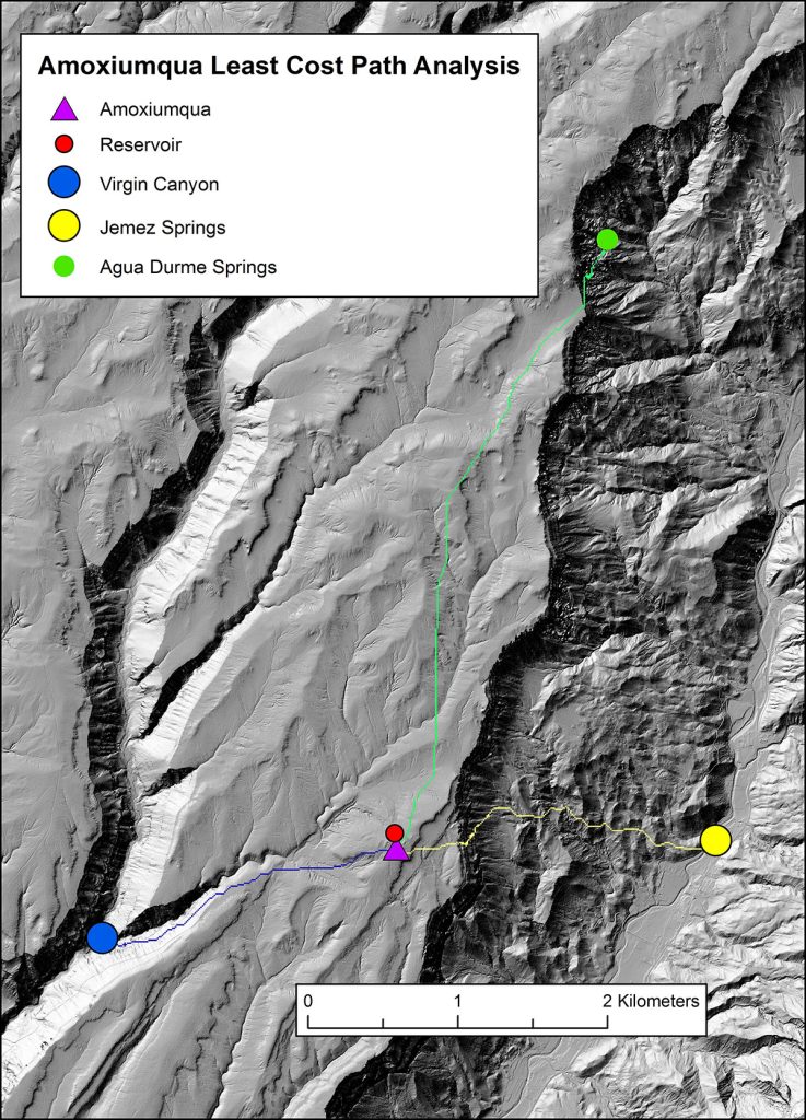
Dr. Aiuvalasit completed a PhD studying relationships between climate change, hydrology and water management practices of Ancestral Pueblo peoples in the Jemez Mountains of New Mexico. The Jemez and Pajarito Plateaus of the Jemez Mountains share similar cultural, environmental, and climatic contexts. Beginning in the 15th century large Ancestral Puebloan communities of the Pajarito moved off mesa-tops for lowlands of the Rio Grande while communities on the Jemez Plateau persisted until the 17th century. Researchers long hypothesized that droughts were a driver of depopulation of the Pajarito Plateau, but if so why wasn’t the Jemez abandoned as well? Ancestral Pueblo communities built water storage features (reservoirs) at most large villages in both regions. These communal features (common pool resources) serve as proxies for how communities took collective action to reduce the risk of water scarcity. Geoarchaeological investigations at 15 prehistoric water reservoir features at nine sites across both regions, combined with geospatial analyses of water acquisition times using least-cost analyses, allowed the close evaluation of relationships between communities, water, and climate. Communities of the Jemez Plateau used their reservoirs through the entire length of occupation. Reservoirs on the Pajarito Plateau stopped being used during droughts in the mid-1400s. Subtle differences in precipitation and geohydrology made Pajarito communities more vulnerable to droughts, but key differences in social organization likely played a greater role in the divergent trajectories of this region. Dr. Aiuvalasit continues to work on geospatial analyses associated with this study, and of the long-term relationships between Pueblo communities, water, and hydrology in the Jemez Mountains.
“Common Goods in Uncommon Times” Michael Aiuvalasit (smu.edu)